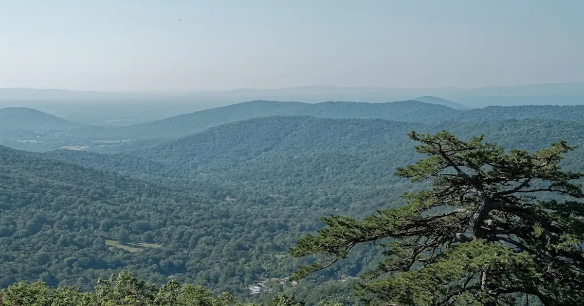
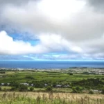
India has one of the largest forest networks in the world, spread across hills, plains, and river basins. Together, forests cover slightly more than one-fifth of the country’s land area. However, this coverage is not evenly distributed across all states.
Some states have dense forests within smaller regions. Others have forests extending over wide geographic areas. Because of this variation, total forest area becomes an important way to compare states.
When forest area is measured by land coverage, clear differences emerge. A few states stand out due to their vast forest stretches and regional scale. Identifying the state with the maximum forest area provides a clearer picture of where India’s largest forest region is located and how forest distribution varies across the country.
India’s Largest Forest by Area in India
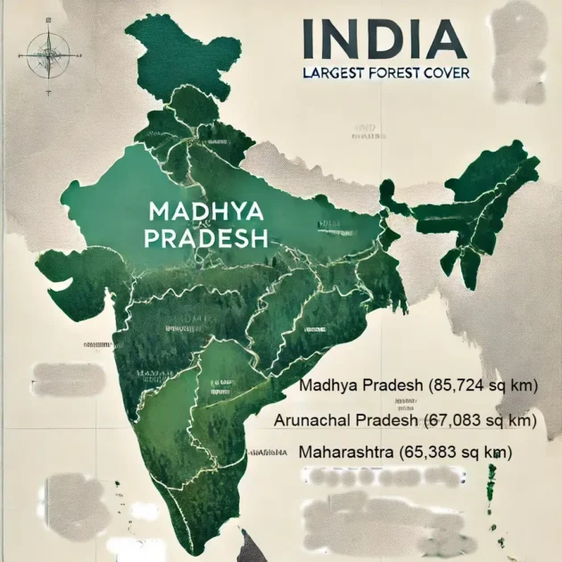
Madhya Pradesh holds the largest forest area in India, covering about 85,724 square kilometres. This places the state first when forests are ranked by total land area.
A major reason is its central location and vast geographic size. Large forest stretches extend across multiple districts, increasing overall forest land compared with other states.
In percentage terms, Madhya Pradesh accounts for nearly 11 percent of India’s total forest cover. This contribution is higher than that of other forest-rich regions.
Based on state-wise forest cover data, Madhya Pradesh ranks at the top for total forest area among Indian states.
This ranking depends on land extent, not tree density. Therefore, states with dense forests but smaller land areas do not lead when forest area is measured by size.
How Forest Area Is Measured in India
Forest area in India is measured using common standards applied across all states. These standards make comparisons clear and consistent.
Two related terms are used. Recorded forest area refers to land legally notified as forest in government records. Forest cover is measured using satellite imagery and reflects tree presence on the ground.
Forest cover is grouped into three categories. Very dense forest has thick canopy cover. Moderately dense forest has medium tree cover. Open forest has lower canopy density.
All three categories contribute to forest cover totals. However, forest area focuses on land extent, not tree thickness. Because of this, states with larger forest land can rank higher even when density differs.
These definitions follow official environmental statistics used for forest assessment in India.
This system explains why forest area and forest cover percentage often show different results. Both describe forests, but they measure different aspects.
Top 5 States with the Largest Forest Area in India
India’s forest area is not evenly spread across the country. A few states account for a large share because of their size, terrain, and land use patterns. When states are compared by total forest land, clear leaders emerge.
These rankings are based on land area under forests, not tree density or forest type. The following states consistently rank at the top due to their wide forest spread.
Madhya Pradesh – Largest Forest Area in India
Madhya Pradesh ranks first in total forest area in India. Its forests cover more than 85,724 square kilometres. This is higher than any other state.
The state’s central location plays an important role. Forest land extends across many districts, creating a continuous and wide forest belt. Large plains and plateaus allow forests to spread over vast areas.
Because of this scale, Madhya Pradesh leads in forest area even when compared with states that have denser forests. While discussing large forest regions, examples like the largest mangrove forest in India, which highlights how forest size varies by type and location.
Arunachal Pradesh – Second Largest Forest Area
Arunachal Pradesh holds the second-largest forest area in India. A major part of the state is covered by forests spread across hills and valleys.
Steep terrain and limited urban development help preserve large forest stretches. Forest land extends across remote regions, increasing total area.
Although population density is low, the geographic spread of forests remains high. This places Arunachal Pradesh just behind Madhya Pradesh in overall forest area.
Chhattisgarh – Central India’s Forest Hub
Chhattisgarh has one of the largest forest areas in central India. Forests cover a significant portion of its land.
Wide plains and gentle terrain support large forest tracts. Many districts have continuous forest coverage.
As a result, the state ranks among the top forested regions by area, even though its forests are not always the densest.
Odisha – Eastern India’s Forest Stronghold
Odisha is a leading forest state in eastern India. Its forests are spread across coastal plains and inland regions.
Large forest belts cover hilly and plateau areas. This adds to the state’s total forest land.
Because of this wide distribution, Odisha ranks high in forest area compared with several other states.
Maharashtra – Large Forest Area Across Regions
Maharashtra also features among the top states by forest area. Forests are spread across western, central, and eastern parts of the state.
The state’s large geographic size allows forests to extend across different regions. This increases total forest land.
Even with urban growth in some areas, Maharashtra maintains a strong position in overall forest area rankings.
Percentage of Forest Cover vs Total Forest Area in India
Forest area and forest cover percentage often create confusion. Both describe forests, but they measure different things.
Total forest area looks at how much land is covered by forests. Forest cover percentage shows how much of a state’s land has tree cover.
Some small states rank high in forest cover percentage because forests occupy much of their limited land. However, their total forest area remains lower.
Larger states may have a lower percentage but still lead in forest area. Madhya Pradesh is a good example. Its forests cover a smaller share of land compared to some states, yet the total area is the highest.
This difference explains why rankings change based on the measure used. Forest area focuses on scale, not proportion.
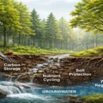
Why India’s Largest Forest Areas Matter Nationally
Large forest areas play an important role at the national level. Their size allows them to influence climate conditions across regions.
Extensive forests help regulate temperature and support stable rainfall patterns. This effect becomes stronger when forests cover wide land areas.
Large forest regions also support rural livelihoods. Many communities depend on forest land for daily needs and income.
The scale of these forests strengthens their national impact. Understanding the role of forests becomes easier when seen alongside broader discussions on forest types, importance, and their role in sustaining life.
Because of their size, the largest forest areas shape land use, regional balance, and long-term sustainability. Their value lies not in density alone, but in how widely they extend across the country.
Challenges Faced by Large Forest Regions in India
Large forest regions in India face growing pressure from multiple directions. One major challenge is deforestation linked to land clearing and changing land use. As population grows, demand for land also increases.
Mining and infrastructure projects create additional stress. Roads, extraction sites, and expansion zones often cut through forest land. This reduces continuous forest stretches and fragments large areas.
Climate variability adds another layer of concern. Changes in rainfall patterns affect forest growth and regeneration. Prolonged dry spells increase the risk of forest degradation.
Besides these factors, human activity around forest edges also affects stability. Even large forest regions feel the impact over time. Managing these pressures remains important to maintain forest scale and continuity.
How India’s Largest Forest Areas Compare Globally
India’s largest forest areas may not match the size of global rainforest regions. However, their regional importance remains strong. These forests support large populations and varied landscapes.
Unlike massive tropical rainforests, India’s forests exist alongside dense human settlements. This makes their role more complex and region-specific.
When viewed alongside examples such as Amazon Rainforest size, scale, biodiversity, and global importance, India’s forests stand out for balance rather than sheer size. They show how forests can coexist with agriculture and development.
This balance highlights India’s contribution to forest conservation at a regional level. The focus remains on maintaining large forest areas within diverse land-use systems.
Conclusion
Madhya Pradesh holds the largest forest area in India. Its wide forest spread places it ahead of all other states by land coverage.
Forest area matters because it reflects scale. Larger forest regions influence climate patterns, land stability, and regional balance more strongly.
Understanding forest area also avoids confusion with forest density or percentage cover. These measures describe different aspects of forest presence.
India’s largest forest areas show how land size shapes forest impact. Preserving their extent remains important for long-term sustainability and regional stability across the country.

